Louisville weekend forecast: thunderstorms likely Saturday, then cooler and sunnier conditions arrive Sunday
What Louisville can expect from Friday through Sunday
Louisville’s late-week warmup is expected to give way to a wetter, stormier Saturday before drier, cooler air settles in for Sunday. Forecast details remain subject to change, but the latest outlook points to the highest likelihood of rain and thunderstorms arriving Saturday, followed by improving conditions Sunday and into early next week.
Friday: Warm with periodic storm chances
Friday is forecast to be unusually mild for early March, with afternoon highs in the mid-70s. Rain and thunderstorm chances are expected to be present but not constant, with the best window for showers and storms during the first half of the day. Gusty southerly winds are also possible at times.
- High temperature: near 76°F
- Rain/thunderstorm chance: around 40% during the day
- Friday night: low near 63°F with additional late-night shower and thunderstorm chances
Saturday: Highest rain risk of the weekend
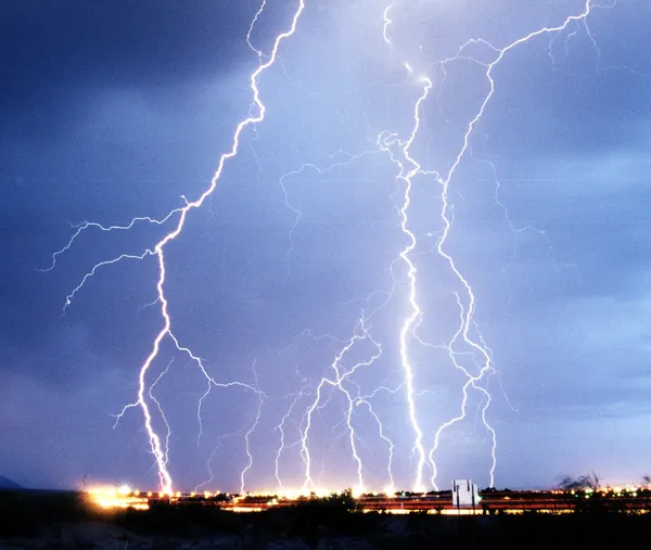
Saturday is currently projected to be the most impactful day of the weekend from a rainfall standpoint. Showers are expected, and at least some thunderstorm activity is possible. The probability of measurable precipitation is forecast to be high, and rainfall totals could add up quickly during heavier downpours.
- Rain and possible thunderstorms expected
- High temperature: near 71°F
- Chance of precipitation: 100%
- Potential rainfall amounts: generally between one-half and three-quarters of an inch
Forecast confidence is strongest on timing the wettest period for Saturday, with improving conditions expected by Sunday.
Saturday night into Sunday: Showers fade, skies trend brighter
Rain chances are expected to drop off Saturday night, with only a smaller chance of lingering showers early in the evening. By Sunday, the forecast calls for mostly sunny skies and cooler temperatures—an abrupt change from the week’s springlike readings.
- Saturday night: about a 30% chance of showers early, then mostly cloudy; low near 45°F
- Sunday: mostly sunny; high near 61°F
- Sunday night: mostly clear; low near 44°F
Why forecasts can shift—and what to watch
Rain and thunderstorm forecasts can change quickly as weather systems and frontal boundaries evolve. For residents planning travel, outdoor events, or athletics, the key items to monitor through the weekend are: the timing of Saturday’s heaviest rain, the potential for thunderstorms embedded in the rain shield, and any localized flooding concerns in areas that repeatedly see downpours.
Conditions are expected to turn quieter early next week, with sunshine returning Monday and another chance of showers and thunderstorms reappearing Monday night into Tuesday.

Louisville Metro Council Committees Convene for Key Policy and Infrastructure Sessions
Morning Briefing: Highlands Growth, Major Crime Busts, and the Countdown to Soccer Season

Official City Roundup: Health Advisories, Traffic Alerts, and Public Hearings