Winter Weather Advisory for Louisville region through Wednesday morning raises risks for slick commuting conditions
Advisory timing targets the Wednesday morning rush
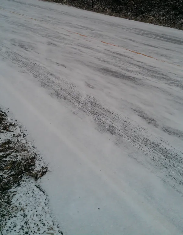
A Winter Weather Advisory is in effect across the Louisville metro and portions of surrounding Kentucky and southern Indiana counties during the early hours of Wednesday, Jan. 21, 2026, a window that overlaps with the region’s main commuting period. The advisory period runs from 4 a.m. to 11 a.m. Eastern, when temperatures and road-surface conditions are expected to support ice formation on untreated roads.
Forecasters expect precipitation to develop before daybreak and fall primarily as freezing drizzle or freezing rain. Light snow could mix in after sunrise. With road temperatures projected to be well below freezing overnight, even small amounts of ice can create hazardous travel conditions, particularly on bridges, overpasses and less-traveled streets that cool more quickly.
What is expected and why it matters
The advisory highlights a common winter-weather problem for the Ohio Valley: precipitation arriving as temperatures hover near the freezing mark. When road surfaces remain below 32°F, moisture can freeze on contact, leading to patches of black ice that are difficult for drivers to see.
- Primary precipitation type: freezing drizzle/freezing rain early Wednesday
- Secondary risk: a light mix with snow after sunrise
- Main impact: slippery roads likely during the morning commute
- Improvement expected: mid- to late morning as surface temperatures rise above freezing
Counties included in the advisory area
The advisory covers Jefferson County and parts of the broader Louisville region in Kentucky, along with several counties in southern Indiana. In Kentucky, that includes counties such as Jefferson, Bullitt, Oldham, Shelby, Spencer, Nelson, Hardin and others in the north-central portion of the state. On the Indiana side, counties include areas such as Clark, Floyd and Harrison, among others. The advisory footprint reflects where early-morning icing is most likely given expected temperatures and precipitation timing.
Commute and travel considerations
Travel conditions can vary sharply over short distances during icing events. Drivers may encounter wet pavement in one neighborhood and frozen surfaces a few miles away, especially before sunrise. Any slowdown in warming can prolong slick conditions, while a faster rise above freezing would shorten the threat window.
Key travel risk: slick spots are most likely before midmorning, when road temperatures are coldest and precipitation is expected.
Transportation agencies typically urge reduced speeds, increased following distance and gentle braking during icing events. Conditions often improve first on heavily traveled, treated roads, while secondary streets and elevated roadways can remain slick longer.
Looking beyond Wednesday morning
Forecast discussions for the region also point to continued winter-weather monitoring later in the week, with attention turning to the potential for a more significant system over the upcoming weekend. For Wednesday, the immediate operational concern remains the narrow window of freezing precipitation and the potential for travel disruptions during the morning commute.