Slushy Skies and Slippery Streets: A Messy Tuesday Ahead for Louisville
A Winter Mix Returns to the Metro
Louisville residents should prepare for a damp and potentially hazardous day as a winter weather system moves through the Ohio Valley this Tuesday, February 3, 2026. While the day begins with relatively quiet conditions, the National Weather Service has issued a Winter Weather Advisory for the region, warning of a transition from cold rain to wet, slushy snow that could complicate travel through the afternoon and evening hours.
Morning: A Cold and Quiet Start
The morning hours in Louisville will start out cold but mostly dry. Temperatures are expected to hover around the 30°F mark during the early commute, with thick cloud cover moving in from the north. While some light flurries or a dusting of snow may be possible across southern Indiana and the northernmost parts of the Louisville metro as early as 10:00 AM, the primary precipitation is expected to hold off until later in the day. Pedestrians and drivers should remain cautious of lingering icy patches on side streets from previous cold snaps, even before the new round of moisture arrives.
Afternoon: The Transition to Rain and Slush
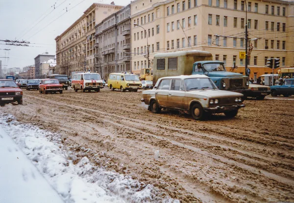
As we move into the afternoon, a low-pressure system will draw moisture into the area, bringing the high temperature for the day to approximately 35°F. This marginal temperature will create a messy mix of precipitation types. Meteorologists predict a transition period starting between 1:00 PM and 3:00 PM, where cold rain will begin to mix with heavy, wet snowflakes. Because ground temperatures remain near freezing, this mixture is likely to create a layer of slush on the roads rather than deep snow drifts. Current predictions suggest a total accumulation of a coating to one inch for the Louisville area, though slightly higher amounts of 1 to 2 inches are possible just to the north.
Evening: Commute Concerns and Overnight Chill
The greatest impact on the city is expected during the Tuesday evening commute. As the sun sets and temperatures begin to slide back toward an overnight low of 23°F, any slush or standing water on the roads may begin to freeze. The Winter Weather Advisory remains in effect until midnight, by which time the steady precipitation is expected to taper off into scattered flurries. Wind speeds will remain relatively light, but the combination of moisture and falling temperatures will make for a raw, chilly night across the city.
Key Weather Alerts and Safety Information
- Winter Weather Advisory: In effect from 10:00 AM Tuesday until midnight.
- Precipitation: A mix of rain and wet snow, with total slushy accumulations of up to 1 inch in the city.
- Travel Impact: Expect slippery road conditions and reduced visibility during the afternoon and evening hours.
- Temperature Range: A high of 35°F dropping to a low of 23°F overnight.
City officials recommend allowing extra time for travel this evening and staying updated on local radar as the rain-snow line fluctuates across Jefferson County.