Clipper Alert: Snow and Frigid Winds Set to Churn Through Louisville
Clipper Alert: Snow and Frigid Winds Set to Churn Through Louisville
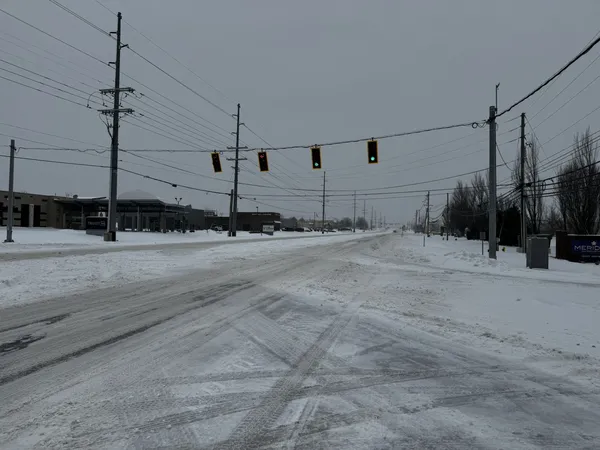
Louisville residents should prepare for a volatile weather day as a fast-moving "clipper" system sweeps across the region. As the lead editor for louisville.news, I have analyzed the latest National Weather Service data, and the forecast for today, Friday, February 6, 2026, suggests a day of two distinct halves: a messy, wintry morning followed by a dramatic arctic plunge and high winds that will significantly impact the evening commute.
Morning: A Messy Mix of Ice and Snow
The day begins with hazardous conditions across the metro area. Forecasters have issued a Winter Weather Advisory for central Kentucky as the clipper system moves through the Ohio Valley. Between dawn and 11:00 AM, expect a light wintry mix featuring both snow and freezing rain. While accumulations are expected to be relatively light—ranging from a dusting to roughly two inches in the heaviest bands—the presence of freezing rain creates a high risk for slick spots on bridges and overpasses. Temperatures in the early morning will hover near freezing, eventually climbing to a daytime high of 39°F by midday as the precipitation transitions into a cold rain.
Afternoon: Rising Winds and Rain Transitions
By early afternoon, the wintry mix will likely shift to a steady rain for a few hours. However, do not let the slight rise in temperature offer a false sense of security. The primary concern during the afternoon hours will be the wind. A powerful arctic cold front is trailing the clipper, and the sharpening pressure gradient will result in wind gusts reaching up to 40 mph. For those driving on I-65 or I-64, these gusts could create sudden visibility issues and difficult handling. The National Weather Service warns that these conditions may lead to brief whiteout scenarios if rain transitions back into snow during the peak of the afternoon commute.
Evening: The Arctic Plunge
As the sun sets, the brief thaw ends abruptly. The arctic air mass will barrel through the region, causing temperatures to plummet. Any remaining rain will switch back to snow before 11:00 PM. By late tonight, the thermometer is expected to hit a low of approximately 17°F. The rapid drop in temperature combined with residual moisture on the roads could lead to "flash freezing," making overnight travel extremely dangerous. Wind chills will likely drop into the single digits by the early hours of Saturday morning.
Safety and Travel Precautions
Due to the combination of light snow, potential icing, and high-velocity winds, residents are urged to take the following precautions today:
- Allow significant extra travel time for both the morning and evening commutes.
- Secure loose outdoor furniture or decorations that could be displaced by 40 mph gusts.
- Ensure pets are brought indoors and pipes are protected before the deep freeze tonight.
- Be mindful of black ice on sidewalks and secondary roads after sunset.