A Chilly Double Whammy: Light Snow Dusting Followed by a Sub-Zero Arctic Plunge
Louisville Faces a Challenging Friday
Louisville is bracing for a complex weather day this Friday, January 30, 2026, as the region deals with a combination of lingering winter impacts and a new, aggressive cold front. Local meteorologists have issued a Weather Impact Alert Day to help residents prepare for what is being described as a weather "double whammy": a morning of light snow followed by a dangerous plunge into sub-zero temperatures by nightfall.
Morning: Light Snow and Slick Commutes
The day begins with a narrow band of light, dry, and fluffy snow developing along the I-64 corridor and spreading across the city. While total accumulations are expected to be minor—generally a dusting to one inch—the timing is critical. Coming off a week of heavy winter activity, these fresh flakes could quickly coat previously treated roads, making the morning commute treacherous. Drivers are urged to slow down and allow extra travel time. Temperatures in the early hours will hover in the high teens to low 20s, with mist further reducing visibility in some areas.
Afternoon: Gloomy Skies and a Brief Reprieve
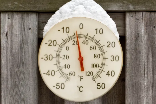
By the afternoon, the primary snow band is expected to shift southeast of Louisville toward central and eastern Kentucky. The city will likely remain under a heavy blanket of clouds with intermittent mist. High temperatures are forecasted to peak between 24 and 27 degrees Fahrenheit. While this is slightly warmer than the deep freeze that followed the major storm earlier in the week, it remains well below freezing, ensuring that any snow or ice on the ground stays firmly in place. Pedestrians should remain cautious of "hidden" ice patches under the fresh dusting of snow.
Evening and Night: The Arctic Arrival
The most significant weather shift occurs after sunset. A massive cold front is set to unleash life-threatening temperatures across the Commonwealth. By Friday night and heading into Saturday morning, the mercury will drop into sub-zero territory. Lows are expected to fall between -4 and -14 degrees Fahrenheit, with wind chills potentially reaching as low as -11 degrees. This extreme cold poses a serious risk for frostbite and hypothermia, as well as a significant threat to residential plumbing.
Active Alerts and Safety Notices
The National Weather Service and local agencies have several notices in effect for the Louisville area:
- Weather Impact Alert Day: Active through Friday for the combination of light snow and extreme cold.
- Special Weather Statement: Warning of minor travel impacts due to the morning snow band coating roads.
- Cold Weather Advisory: Effective starting late Friday night as temperatures begin their sub-zero descent.
Residents are encouraged to check on elderly neighbors, bring all pets indoors, and ensure that vehicles are properly winterized before the overnight plunge. Those traveling should keep an emergency kit in their car containing blankets and water.